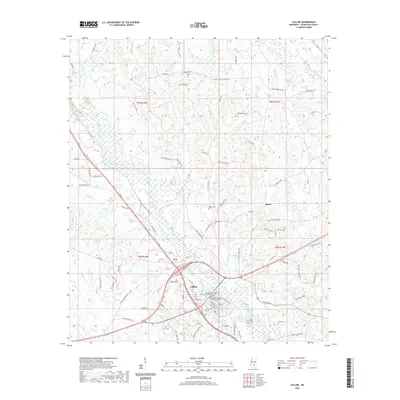
2020 Map of Collins
USGS Topo · Published 2020About this map
Collins serves as the seat of Covington County, characterized by a concentrated municipal layout that includes the Covington County Courthouse and the Covington County Chancery Building. The surrounding landscape is defined by the winding course of Okatoma Creek and its many tributaries, such as Blakely Cr and Rogers Cr. Smaller settlements like Ora and Salem are connected by a network of rural roads, including Ora Williamsburg Rd and Byrd Town Rd, reflecting the area's agricultural and timber-based character. The terrain is marked by distinct hydrological features like Ora Swamp and Gibson Lake. Numerous family and community landmarks are preserved here, including the Collins Cem, Blakely Cem, and Kola Cem, alongside rural routes like Blakely Creek Church Rd that point to the historical social centers of this Mississippi region.
Find a feature on this map
101 named features on this map. Tap any name to fly to it.
Don’t see what you’re looking for? This feature index may not catch every label — zoom into the map to look around manually.
Map Details
Editions of this 2020 Collins Map
This is the sole edition of this map. No revisions or reprints were ever made.
Other maps of this area

1953 · Hattiesburg
USGS Topo · 1:250,000

1958 · Hattiesburg
USGS Topo · 1:250,000

1964 · Seminary
USGS Topo · 1:24,000

1965 · Hot Coffee
USGS Topo · 1:24,000

1974 · Lone Star
USGS Topo · 1:24,000

1974 · Williamsburg
USGS Topo · 1:24,000

1974 · Collins
USGS Topo · 1:24,000

1974 · Lake Mike Connor
USGS Topo · 1:24,000

1975 · Taylorsville
USGS Topo · 1:24,000

1975 · Mize
USGS Topo · 1:24,000