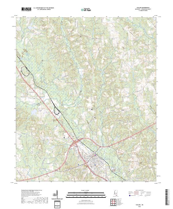
2024 Map of Collins
USGS Topo · Published 2024About this map
Collins serves as the focal point of this Mississippi landscape, anchored by the Covington County Courthouse and Covington County Chancery Building. The settlement patterns here follow the winding course of Okatoma Creek and its many tributaries, including Town Creek and Shelby Creek. These waterways, interspersed with the marshy grounds of Ora Swamp, historically dictated the placement of early homesteads and transport routes. Evidence of long-standing community hubs is visible in the numerous burial sites and gathering places that dot the terrain, from the Salem School and Salem Cem in the east to the clusters at Ora and Salem. Rural life is further mapped through family-named thoroughfares like Jones Chapel Rd and George Speed Rd, which connect outlying farms to the central rail and road corridors passing through the county seat.
Find a feature on this map
126 named features on this map. Tap any name to fly to it.
Don’t see what you’re looking for? This feature index may not catch every label — zoom into the map to look around manually.
Map Details
Editions of this 2024 Collins Map
This is the sole edition of this map. No revisions or reprints were ever made.
Other maps of this area

1953 · Hattiesburg
USGS Topo · 1:250,000

1958 · Hattiesburg
USGS Topo · 1:250,000

1964 · Seminary
USGS Topo · 1:24,000

1965 · Hot Coffee
USGS Topo · 1:24,000

1974 · Lone Star
USGS Topo · 1:24,000

1974 · Williamsburg
USGS Topo · 1:24,000

1974 · Collins
USGS Topo · 1:24,000

1974 · Lake Mike Connor
USGS Topo · 1:24,000

1975 · Taylorsville
USGS Topo · 1:24,000

1975 · Mize
USGS Topo · 1:24,000