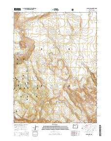
2014 Map of Collins Rim
USGS Topo · Published 2014About this map
Collins Rim rises as a prominent geographic feature within the high desert landscape of Lake County, where the Fremont National Forest preserves a remote and sparsely settled expanse. The land is marked by isolated outposts like Frakes Cabin and Mate Cabin, which reflect the historical presence of range management and early forest usage. Water management is central to this environment, evidenced by a series of impoundments and natural features including O'Keefe Reservoir, Lane Reservoir Number Four, and Big Lake.
Find a feature on this map
36 named features on this map. Tap any name to fly to it.
Don’t see what you’re looking for? This feature index may not catch every label — zoom into the map to look around manually.
Map Details
Editions of this 2014 Collins Rim Map
This is the sole edition of this map. No revisions or reprints were ever made.
Other maps of this area

1886 · Alturas
USGS Topo · 1:250,000

1889 · Long Valley
USGS Topo · 1:250,000

1892 · Alturas
USGS Topo · 1:250,000

1954 · Vya
USGS Topo · 1:250,000

1954 · Alturas
USGS Topo · 1:250,000

1955 · Klamath Falls
USGS Topo · 1:250,000

1955 · Adel
USGS Topo · 1:250,000

1957 · Adel
USGS Topo · 1:250,000

1958 · Alturas
USGS Topo · 1:250,000

1958 · Klamath Falls
USGS Topo · 1:250,000