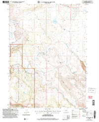
2004 Map of Collins Rim
USGS Topo · Published 2007About this map
Collins Rim defines the high desert topography of this region, separating the drainage of Twentymile Creek from the expansive flats of Big Valley. The landscape is dotted with evidence of early 21st-century back-country use and rangeland management, including scattered outposts like Collins Cabin, Mate Cabin, and Haw Cabin. These small structures, along with Barley Camp, suggest a persistent human presence tied to the seasonal needs of timber or livestock within the Fremont National Forest.
Find a feature on this map
25 named features on this map. Tap any name to fly to it.
Don’t see what you’re looking for? This feature index may not catch every label — zoom into the map to look around manually.
Map Details
Editions of this 2004 Collins Rim Map
This is the sole edition of this map. No revisions or reprints were ever made.
Other maps of this area

1886 · Alturas
USGS Topo · 1:250,000

1889 · Long Valley
USGS Topo · 1:250,000

1892 · Alturas
USGS Topo · 1:250,000

1954 · Vya
USGS Topo · 1:250,000

1954 · Alturas
USGS Topo · 1:250,000

1955 · Klamath Falls
USGS Topo · 1:250,000

1955 · Adel
USGS Topo · 1:250,000

1957 · Adel
USGS Topo · 1:250,000

1958 · Alturas
USGS Topo · 1:250,000

1958 · Klamath Falls
USGS Topo · 1:250,000