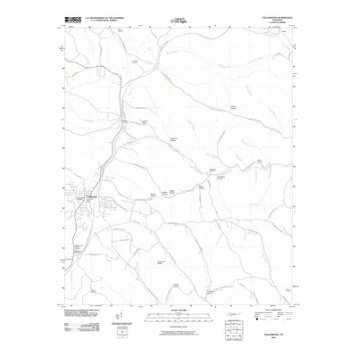
2010 Map of Collinwood
USGS Topo · Published 2010About this map
Collinwood serves as the primary hub in this Wayne County landscape, centered at the junction of the historic Natchez Trace Pkwy and local routes like Catawba St. The terrain is defined by a dense network of ridges and hollows, such as Shelton Ridge and Bucksnort Ridge, which dictate the winding paths of roads like Shelton Ridge Rd. Family names are deeply etched into the topography, seen in numerous private burial grounds including Risner Cemetery, McCall Cemetery, and Dixon Cemetery.
Find a feature on this map
75 named features on this map. Tap any name to fly to it.
Don’t see what you’re looking for? This feature index may not catch every label — zoom into the map to look around manually.
Map Details
Editions of this 2010 Collinwood Map
This is the sole edition of this map. No revisions or reprints were ever made.
Other maps of this area

1905 · Waynesboro
USGS Topo · 1:125,000

1936 · Westpoint
USGS Topo · 1:24,000

1936 · Collinwood
USGS Topo · 1:24,000

1936 · Light
USGS Topo · 1:24,000

1936 · Negro Hollow
USGS Topo · 1:24,000

1936 · Cypress Inn
USGS Topo · 1:24,000

1936 · Three Churches
USGS Topo · 1:24,000
1936 · St. Joseph
USGS Topo · 1:24,000

1936 · Waynesboro
USGS Topo · 1:24,000

1936 · Ovilla
USGS Topo · 1:24,000