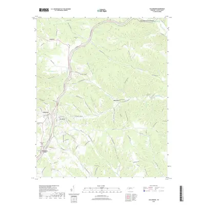
2019 Map of Collinwood
USGS Topo · Published 2019About this map
The Natchez Trace Pkwy snakes through the deeply dissected ridges of Wayne County, serving as the central artery for this part of the Tennessee landscape. The town of Collinwood and the adjacent community of Woodlawn sit at a convergence of local routes, including Co Hwy 1780 and Co Hwy 912. The terrain is defined by a dense network of hollows, such as Haggerty Hollow, Lindsey Hollow, and Thompson Hollow, which separate prominent elevations like Shelton Ridge and Bucksnort Ridge.
Find a feature on this map
91 named features on this map. Tap any name to fly to it.
Don’t see what you’re looking for? This feature index may not catch every label — zoom into the map to look around manually.
Map Details
Editions of this 2019 Collinwood Map
This is the sole edition of this map. No revisions or reprints were ever made.
Other maps of this area

1905 · Waynesboro
USGS Topo · 1:125,000

1936 · Westpoint
USGS Topo · 1:24,000

1936 · Collinwood
USGS Topo · 1:24,000

1936 · Light
USGS Topo · 1:24,000

1936 · Negro Hollow
USGS Topo · 1:24,000

1936 · Cypress Inn
USGS Topo · 1:24,000

1936 · Three Churches
USGS Topo · 1:24,000
1936 · St. Joseph
USGS Topo · 1:24,000

1936 · Waynesboro
USGS Topo · 1:24,000

1936 · Ovilla
USGS Topo · 1:24,000