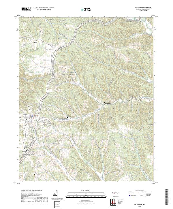
2022 Map of Collinwood
USGS Topo · Published 2022About this map
The Natchez Trace Parkway carves through the undulating topography of Wayne County, Tennessee, passing north of the established settlement of Collinwood. This modern survey reveals a landscape where road networks like Catawba Dr and Keeton Hollow Rd navigate a complex system of ridges and hollows, including Shelton Ridge and Daniel Hollow. Smaller communities such as Woodlawn, Shawnette, and McGlamery Stand are identified by their proximity to various family-named cemeteries and creek branches. Genealogists will find a high density of burial sites across the quadrangle, from the Wayne County Memory Gardens Cem near the town center to the more remote Risner Cem and Bucksnort Cem. The drainage patterns are defined by numerous tributaries such as Green River and Last Butler Cr, illustrating the relationship between the area's hydrology and its scattered rural homesteads.
Find a feature on this map
101 named features on this map. Tap any name to fly to it.
Don’t see what you’re looking for? This feature index may not catch every label — zoom into the map to look around manually.
Map Details
Editions of this 2022 Collinwood Map
This is the sole edition of this map. No revisions or reprints were ever made.
Other maps of this area

1905 · Waynesboro
USGS Topo · 1:125,000

1936 · Westpoint
USGS Topo · 1:24,000

1936 · Collinwood
USGS Topo · 1:24,000

1936 · Light
USGS Topo · 1:24,000

1936 · Negro Hollow
USGS Topo · 1:24,000

1936 · Cypress Inn
USGS Topo · 1:24,000

1936 · Three Churches
USGS Topo · 1:24,000
1936 · St. Joseph
USGS Topo · 1:24,000

1936 · Waynesboro
USGS Topo · 1:24,000

1936 · Ovilla
USGS Topo · 1:24,000