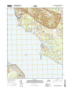
2016 Map of Colonial Beach North
USGS Topo · Published 2016About this map
The Potomac River dominates this coastal landscape, serving as the border between Charles County, Maryland, and Westmoreland County, Virginia. At the southern reach, the developed grid of Colonial Beach and Potomac Beach borders Monroe Bay, while the northern Maryland shore is defined by a series of prominent points and agricultural clusters. Morgantown sits just below the Harry W Nice Memorial Bridge, a vital crossing that connects the two states.
Find a feature on this map
109 named features on this map. Tap any name to fly to it.
Don’t see what you’re looking for? This feature index may not catch every label — zoom into the map to look around manually.
Map Details
Editions of this 2016 Colonial Beach North Map
This is the sole edition of this map. No revisions or reprints were ever made.
Other maps of this area

1889 · Fredericksburg
USGS Topo · 1:125,000

1892 · Fredericksburg
USGS Topo · 1:125,000

1892 · Montross
USGS Topo · 1:62,500

1894 · Wicomico
USGS Topo · 1:62,500

1894 · Fredericksburg
USGS Topo · 1:125,000

1895 · Wicomico
USGS Topo · 1:62,500

1895 · Nomini
USGS Topo · 1:125,000

1895 · Montross
USGS Topo · 1:62,500

1898 · Nomini
USGS Topo · 1:125,000

1902 · Wicomico
USGS Topo · 1:62,500