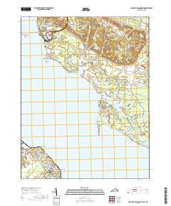
2019 Map of Colonial Beach North
USGS Topo · Published 2019About this map
Potomac River shorelines define this 2019 survey, marking the intersection of Maryland and Virginia across a landscape of tidal creeks and long-established settlements. Along the northern bank in Charles County, Maryland, the terrain is shaped by the complex drainage of Piccowaxen Creek and Cuckold Creek, where small communities like Morgantown and Mount Victoria sit inland from prominent landmarks such as Lower Cedar Point. The area's spiritual and social history is anchored by several institutions, including Good Hope Baptist Church and Old Christ Church, while the south bank in Westmoreland County shows the urban grid of Colonial Beach and Potomac Beach reaching toward White Point. The crossing of the Harry W Nice Memorial Bridge serves as the primary modern artery connecting these two historic riverfront regions, while local aviation is served by the Pilots Cove Airport near Tompkinsville.
Find a feature on this map
127 named features on this map. Tap any name to fly to it.
Don’t see what you’re looking for? This feature index may not catch every label — zoom into the map to look around manually.
Map Details
Editions of this 2019 Colonial Beach North Map
This is the sole edition of this map. No revisions or reprints were ever made.
Other maps of this area

1889 · Fredericksburg
USGS Topo · 1:125,000

1892 · Fredericksburg
USGS Topo · 1:125,000

1892 · Montross
USGS Topo · 1:62,500

1894 · Wicomico
USGS Topo · 1:62,500

1894 · Fredericksburg
USGS Topo · 1:125,000

1895 · Wicomico
USGS Topo · 1:62,500

1895 · Nomini
USGS Topo · 1:125,000

1895 · Montross
USGS Topo · 1:62,500

1898 · Nomini
USGS Topo · 1:125,000

1902 · Wicomico
USGS Topo · 1:62,500