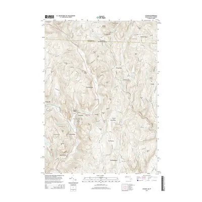
2015 Map of Colrain
USGS Topo · Published 2015About this map
The East Branch North River and its numerous tributaries, such as Vaughn Brook and Borden Brook, carve through the complex topography of Franklin County where Massachusetts meets Vermont. This landscape is defined by its deep colonial history, evidenced by the sites of Fort Morrison, Fort Lucas, and Fort Morris, which reflect the region's frontier past. Industrial and agricultural hubs like Colrain, Lyonsville, and Foundry Village sit along the valley floors, connected by the historical Arthur Smith Covered Bridge. Steep elevations like Aunt Sophies Peak and the Catamount Hills rise above the river basins, while numerous family-named hills, including Barber Hill and Franklin Hill, point to generations of upland settlement. Small hilltop hamlets such as West Leyden and Packer Corner remain distinct, anchored by local landmarks like the Brick School Cem and various family burial grounds including Billings Cem and the Henry Cem.
Find a feature on this map
143 named features on this map. Tap any name to fly to it.
Don’t see what you’re looking for? This feature index may not catch every label — zoom into the map to look around manually.
Map Details
Editions of this 2015 Colrain Map
This is the sole edition of this map. No revisions or reprints were ever made.
Other maps of this area

1886 · Hawley
USGS Topo · 1:62,500

1889 · Wilmington
USGS Topo · 1:62,500

1890 · Hawley
USGS Topo · 1:62,500

1890 · Greenfield
USGS Topo · 1:62,500

1891 · Wilmington
USGS Topo · 1:62,500

1891 · Brattleboro
USGS Topo · 1:62,500

1893 · Brattleboro
USGS Topo · 1:62,500

1894 · Greenfield
USGS Topo · 1:62,500

1894 · Hawley
USGS Topo · 1:62,500

1899 · Wilmington
USGS Topo · 1:62,500