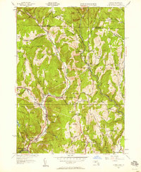
1945 Map of Colrain
USGS Topo · Published 1958About this map
Griswoldville and Lyonsville anchor the industrial and social landscape along the North River in this mid-century portrait of northern Franklin County. The map details a valley of tight-knit villages including Foundry Village and Shattuckville, where the river's energy historically fueled local manufacturing. Away from the water, the terrain climbs toward peaks like Aunt Sophies Peak and Amidon Pinnacle, reflecting a rural economy of upland farming and timber.
Find a feature on this map
121 named features on this map. Tap any name to fly to it.
Don’t see what you’re looking for? This feature index may not catch every label — zoom into the map to look around manually.
Map Details
Editions of this 1945 Colrain Map
This is the sole edition of this map. No revisions or reprints were ever made.
Other maps of this area

1886 · Hawley
USGS Topo · 1:62,500

1889 · Wilmington
USGS Topo · 1:62,500

1890 · Hawley
USGS Topo · 1:62,500

1890 · Greenfield
USGS Topo · 1:62,500

1891 · Wilmington
USGS Topo · 1:62,500

1891 · Brattleboro
USGS Topo · 1:62,500

1893 · Brattleboro
USGS Topo · 1:62,500

1894 · Greenfield
USGS Topo · 1:62,500

1894 · Hawley
USGS Topo · 1:62,500

1899 · Wilmington
USGS Topo · 1:62,500