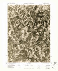
1975 Map of Colrain
USGS Topo · Published 1981About this map
Colrain and its surrounding villages are captured in this 1975 orthophotograph, which reveals the dense forested hills and narrow river valleys of Franklin County. The imagery highlights the distinct settlement patterns concentrated along the waterways, particularly the cluster of Foundry Village and Griswoldville along the North River. Further south, Shattuckville sits near the confluence where the river meets the Deerfield River. This map provides a clear view of the rural landscape before major modern development, showing the agricultural clearings that dot the terrain between Leyden and West Leyden. The paths of the East Branch and West Branch show how the topography dictated the layout of local roads and small industrial hamlets, making it an essential resource for tracing the 20th-century footprint of these historic Massachusetts towns.
Find a feature on this map
12 named features on this map. Tap any name to fly to it.
Don’t see what you’re looking for? This feature index may not catch every label — zoom into the map to look around manually.
Map Details
Editions of this 1975 Colrain Map
This is the sole edition of this map. No revisions or reprints were ever made.
Other maps of this area

1886 · Hawley
USGS Topo · 1:62,500

1889 · Wilmington
USGS Topo · 1:62,500

1890 · Hawley
USGS Topo · 1:62,500

1890 · Greenfield
USGS Topo · 1:62,500

1891 · Wilmington
USGS Topo · 1:62,500

1891 · Brattleboro
USGS Topo · 1:62,500

1893 · Brattleboro
USGS Topo · 1:62,500

1894 · Greenfield
USGS Topo · 1:62,500

1894 · Hawley
USGS Topo · 1:62,500

1899 · Wilmington
USGS Topo · 1:62,500