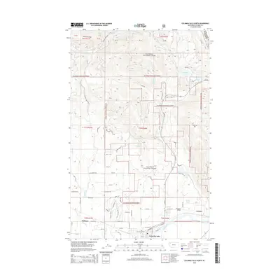
2014 Map of Columbia Falls North
USGS Topo · Published 2014About this map
Columbia Falls sits at the southern edge of this study, positioned where the Flathead River emerges into the Flathead Valley. The landscape transitions sharply from the developed corridors near Halfmoon and Conkelley into the steep, timbered slopes of the Flathead National Forest. This 2014 survey documents a complex network of forest roads and residential lanes, such as Trumbull Canyon Rd and N Fork Rd, that push into the foothills of the Whitefish Range.
Find a feature on this map
68 named features on this map. Tap any name to fly to it.
Don’t see what you’re looking for? This feature index may not catch every label — zoom into the map to look around manually.
Map Details
Editions of this 2014 Columbia Falls North Map
This is the sole edition of this map. No revisions or reprints were ever made.
Other maps of this area

1906 · Kintla Lakes
USGS Topo · 1:125,000

1938 · Kintla Lakes
USGS Topo · 1:125,000

1943 · Kalispell
USGS Topo · 1:125,000

1957 · Kalispell
USGS Topo · 1:250,000

1960 · Kalispell
USGS Topo · 1:250,000

1961 · Kalispell
USGS Topo · 1:250,000

1962 · Columbia Falls South
USGS Topo · 1:24,000

1962 · Doris Mountain
USGS Topo · 1:24,000

1962 · Rose Crossing
USGS Topo · 1:24,000

1962 · Hungry Horse
USGS Topo · 1:24,000