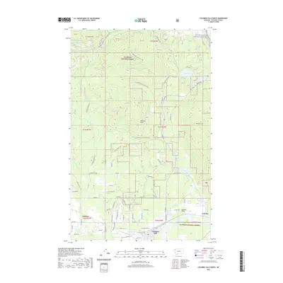
2020 Map of Columbia Falls North
USGS Topo · Published 2020About this map
Columbia Falls serves as the gateway to the northern reaches of the Flathead Valley on this modern survey. The map details the transition from the developed valley floor to the dense wilderness of the Flathead National Forest. This landscape is defined by its water system, ranging from the broad path of the Flathead Wild and Scenic River in the south to the high-elevation Cedar Lake and Spoon Lake tucked within the Whitefish Range. The road network illustrates the area's ongoing use of forest resources, with numerous designated routes such as Natl Forest Develop Road 316G Rd winding through the timbered slopes. Notable industrial and residential pockets like Conkelley and Halfmoon are visible near the valley's base, while geographic landmarks like Teakettle Mtn and Larch Ridge dominate the northern skyline.
Find a feature on this map
77 named features on this map. Tap any name to fly to it.
Don’t see what you’re looking for? This feature index may not catch every label — zoom into the map to look around manually.
Map Details
Editions of this 2020 Columbia Falls North Map
This is the sole edition of this map. No revisions or reprints were ever made.
Other maps of this area

1906 · Kintla Lakes
USGS Topo · 1:125,000

1938 · Kintla Lakes
USGS Topo · 1:125,000

1943 · Kalispell
USGS Topo · 1:125,000

1957 · Kalispell
USGS Topo · 1:250,000

1960 · Kalispell
USGS Topo · 1:250,000

1961 · Kalispell
USGS Topo · 1:250,000

1962 · Columbia Falls South
USGS Topo · 1:24,000

1962 · Doris Mountain
USGS Topo · 1:24,000

1962 · Rose Crossing
USGS Topo · 1:24,000

1962 · Hungry Horse
USGS Topo · 1:24,000