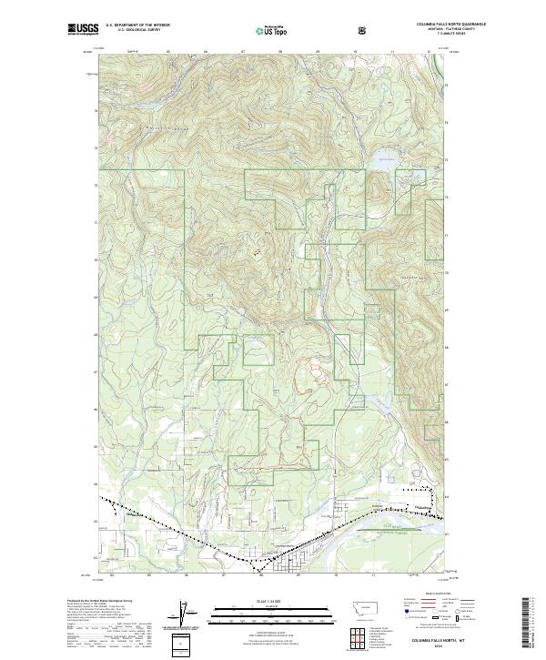
2024 Map of Columbia Falls North
USGS Topo · Published 2024About this map
Flathead National Forest dominates the mountain landscape north of the Flathead Valley, where the steep slopes of the Whitefish Range and Teakettle Mtn descend toward the valley floor. The map highlights a network of forest development roads and trails, including the Morton Springs Trl and Turkey Trot Trl, which provide access to remote water bodies like Spoon Lake, Bailey Lake, and Cedar Lake. At the southern edge of the survey, the Flathead River flows past the rail-side settlement of Conkelley and the community of Halfmoon. The transition from the rugged highlands to the more developed valley is marked by landmarks such as Larch Ridge and the winding course of Trumbull Creek, illustrating the intersection of protected timberlands and local Montana settlements.
Find a feature on this map
64 named features on this map. Tap any name to fly to it.
Don’t see what you’re looking for? This feature index may not catch every label — zoom into the map to look around manually.
Map Details
Editions of this 2024 Columbia Falls North Map
This is the sole edition of this map. No revisions or reprints were ever made.
Other maps of this area

1906 · Kintla Lakes
USGS Topo · 1:125,000

1938 · Kintla Lakes
USGS Topo · 1:125,000

1943 · Kalispell
USGS Topo · 1:125,000

1957 · Kalispell
USGS Topo · 1:250,000

1960 · Kalispell
USGS Topo · 1:250,000

1961 · Kalispell
USGS Topo · 1:250,000

1962 · Columbia Falls South
USGS Topo · 1:24,000

1962 · Doris Mountain
USGS Topo · 1:24,000

1962 · Rose Crossing
USGS Topo · 1:24,000

1962 · Hungry Horse
USGS Topo · 1:24,000