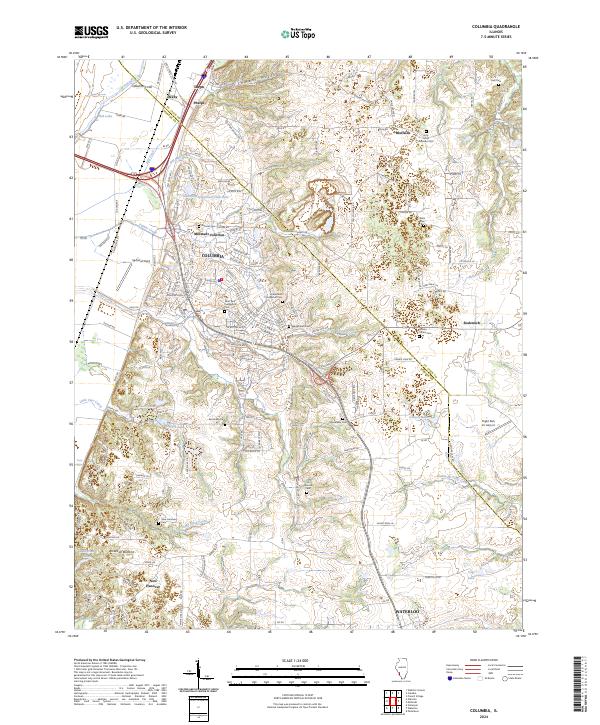
2024 Map of Columbia
USGS Topo · Published 2024About this map
Columbia serves as a central hub in this modern survey of the St Clair Co Monroe Co border, where the steep bluffs of the American Bottoms transition into the uplands. The landscape is defined by its deep historical roots, evidenced by numerous burial sites like Holy Cross Lutheran Cem and Immaculate Conception Cem that reflect early settlement patterns. Transport networks converge here, with the Illinois Central Gulf corridor passing through Millstadt Junction and Phelps. The hydrology is complex, featuring a network of creeks such as Palmer Creek and Wilson Creek that drain toward the Mississippi floodplain. To the south, the village of New Hanover and the northern outskirts of Waterloo anchor the agricultural landscape, while the Flight Park Inc Airport and Columbia Sportsman Club Lake highlight more recent land uses in this long-settled region.
Find a feature on this map
177 named features on this map. Tap any name to fly to it.
Don’t see what you’re looking for? This feature index may not catch every label — zoom into the map to look around manually.
Map Details
Editions of this 2024 Columbia Map
This is the sole edition of this map. No revisions or reprints were ever made.
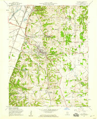
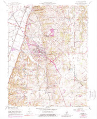
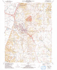
Historical Maps of Phelps Through Time
5 maps found