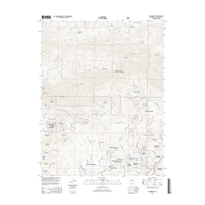
2015 Map of Columbia SE
USGS Topo · Published 2015About this map
Phoenix Lake and Phoenix Reservoir serve as central landmarks in this pocket of the Sierra Nevada foothills, where modern residential expansion meets rugged Gold Country terrain. The landscape is defined by the steep descent toward the S Fork Stanislaus River and the legacy of hydraulic engineering seen in the Columbia Ditch. Historically significant heights like Telegraph Hill, Yankee Hill, and Bald Mtn overlook a series of established communities, including Cedar Ridge, Crystal Falls, and Jupiter. This 2015 data reflects the complex interface between the protected lands of the Stanislaus National Forest and numerous named subdivisions like Apple Valley Estates and Goldmont Forest, illustrating how residential development has integrated into the gulches and ridges once dominated by mining and ranching.
Find a feature on this map
94 named features on this map. Tap any name to fly to it.
Don’t see what you’re looking for? This feature index may not catch every label — zoom into the map to look around manually.
Map Details
Editions of this 2015 Columbia SE Map
This is the sole edition of this map. No revisions or reprints were ever made.
Other maps of this area

1891 · Big Trees
USGS Topo · 1:125,000

1893 · Sonora
USGS Topo · 1:125,000

1894 · Big Trees
USGS Topo · 1:125,000

1896 · Sonora
USGS Topo · 1:125,000

1897 · Sonora
USGS Topo · 1:125,000

1897 · Big Trees
USGS Topo · 1:125,000

1898 · Sonora
USGS Topo · 1:125,000

1901 · Big Trees
USGS Topo · 1:125,000

1947 · Sacramento
USGS Topo · 1:250,000

1947 · San Jose
USGS Topo · 1:250,000