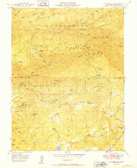
1949 Map of Columbia SE
USGS Topo · Published 1949About this map
Gold mining history permeates the drainages of the South Fork Stanislaus River and Fivemile Creek in this late 1940s survey of Tuolumne County. The landscape is a complex network of steep ridges and gulches, dominated by the Stanislaus National Forest and dotted with numerous active or legacy mining sites including the Indian Girl Mine, Contention Mine, and Mountain Lily Mine. This period captures the transition of the region from its hard-rock mining roots toward new uses, seen in the presence of the Phoenix Powerhouse and the Old Oak Ranch.
Find a feature on this map
56 named features on this map. Tap any name to fly to it.
Don’t see what you’re looking for? This feature index may not catch every label — zoom into the map to look around manually.
Map Details
Editions of this 1949 Columbia SE Map
This is the sole edition of this map. No revisions or reprints were ever made.
Other maps of this area

1891 · Big Trees
USGS Topo · 1:125,000

1893 · Sonora
USGS Topo · 1:125,000

1894 · Big Trees
USGS Topo · 1:125,000

1896 · Sonora
USGS Topo · 1:125,000

1897 · Sonora
USGS Topo · 1:125,000

1897 · Big Trees
USGS Topo · 1:125,000

1898 · Sonora
USGS Topo · 1:125,000

1901 · Big Trees
USGS Topo · 1:125,000

1947 · Sacramento
USGS Topo · 1:250,000

1947 · San Jose
USGS Topo · 1:250,000