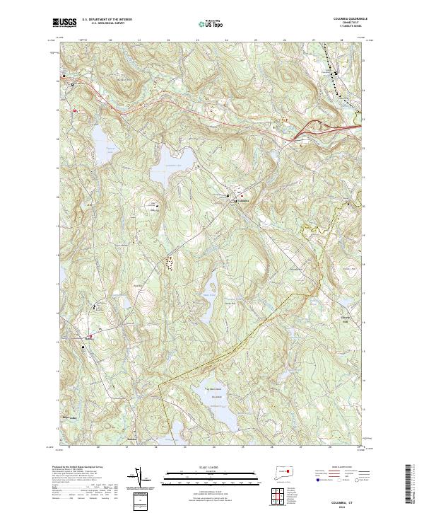
2024 Map of Columbia
USGS Topo · Published 2024About this map
Columbia Lake and its surrounding hilltops define this landscape between the settlements of Columbia and Hebron. The terrain is deeply marked by its glacial history and early American settlement, featuring numerous family and community cemeteries such as the Columbia Burying Grounds, Saint Peter's Cem, and Scovell Cem. Transportation history is visible through the Airline Trl and Hop River Trl, rail-to-trail corridors that follow the paths of former nineteenth-century rail lines through the valleys. The map documents a complex water system, including Mono Pond, Williams Pond, and the southern reach of Andover Lake, connected by numerous brooks like Raymond Brook and Munn Brook. To the south, Amston Lake sits near the crossing of Amston, where local industry once thrived along the waterways. These features together show a rural Connecticut landscape where historic hamlets like Chestnut Hill and Liberty Hill have maintained their distinct character alongside modern recreational corridors.
Find a feature on this map
171 named features on this map. Tap any name to fly to it.
Don’t see what you’re looking for? This feature index may not catch every label — zoom into the map to look around manually.
Map Details
Editions of this 2024 Columbia Map
This is the sole edition of this map. No revisions or reprints were ever made.
Other maps of this area

1892 · Woodstock
USGS Topo · 1:62,500

1892 · Tolland
USGS Topo · 1:62,500

1892 · Norwich
USGS Topo · 1:62,500

1892 · Gilead
USGS Topo · 1:62,500

1921 · Tolland
USGS Topo · 1:62,500

1921 · Woodstock
USGS Topo · 1:62,500

1943 · Fitchville
USGS Topo · 1:31,680

1944 · Marlboro
USGS Topo · 1:31,680

1944 · South Coventry
USGS Topo · 1:31,680

1944 · Columbia
USGS Topo · 1:31,680