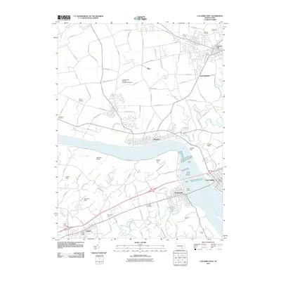
2010 Map of Columbia West
USGS Topo · Published 2010About this map
The Susquehanna River serves as the central divide for this riverfront landscape, separating the borough of Marietta and the city of Columbia from Wrightsville and Hallam on the western bank. The terrain is defined by prominent elevations such as Chickies Rock and Chickies Ridge, which overlook the river's path through the York Valley. Local aviation is well-represented by several small facilities, including the Elizabethtown-Marietta Incorporated Airport and Crumling Airport.
Find a feature on this map
96 named features on this map. Tap any name to fly to it.
Don’t see what you’re looking for? This feature index may not catch every label — zoom into the map to look around manually.
Map Details
Editions of this 2010 Columbia West Map
This is the sole edition of this map. No revisions or reprints were ever made.
Other maps of this area

1902 · Lancaster
USGS Topo · 1:62,500

1904 · Lancaster
USGS Topo · 1:62,500

1908 · Middletown
USGS Topo · 1:62,500

1908 · York
USGS Topo · 1:62,500

1910 · York
USGS Topo · 1:62,500

1912 · Mc Calls Ferry
USGS Topo · 1:62,500

1943 · Lancaster
USGS Topo · 1:62,500

1943 · Middletown
USGS Topo · 1:62,500

1943 · Mc Calls Ferry
USGS Topo · 1:62,500

1948 · Baltimore
USGS Topo · 1:250,000