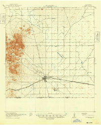
1920 Map of Columbus
USGS Topo · Published 1948About this map
The town of Columbus serves as the central hub of this 1917 survey of Luna County, capturing the borderlands just after a period of intense military activity and international focus. The landscape is defined by the sharp transition between the Hermanas Mountains in the west and the arid flats to the east, crisscrossed by the El Paso and Southwestern railroad. This transportation corridor was vital for the region's ranching economy, connecting remote outposts like Stephenson Ranch and Raseon Ranch to larger markets. Along the southern edge, the United States Mexico boundary is clearly delineated, featuring the Boundary Gate and the New Mexico Chihuahua line. Evidence of early 20th-century rural life is scattered across the desert, from established settlements like Waterloo and Loma Vista to isolated landmarks such as Mayfield School and Sunnyside School, providing a detailed view of the infrastructure supporting this high-desert frontier.
Find a feature on this map
18 named features on this map. Tap any name to fly to it.
Don’t see what you’re looking for? This feature index may not catch every label — zoom into the map to look around manually.
Map Details
Editions of this 1920 Columbus Map
3 editions found
Other maps of this area

1899 · Deming
USGS Topo · 1:125,000

1915 · Deming
USGS Topo · 1:125,000

1917 · Hermanas
USGS Topo · 1:62,500

1917 · Camel Mountain
USGS Topo · 1:62,500

1917 · Columbus
USGS Topo · 1:62,500

1918 · Columbus
USGS Topo · 1:62,500

1918 · Hermanas
USGS Topo · 1:62,500

1920 · Columbus
USGS Topo · 1:62,500

1943 · Hermanas
USGS Topo · 1:62,500

1953 · El Paso
USGS Topo · 1:250,000