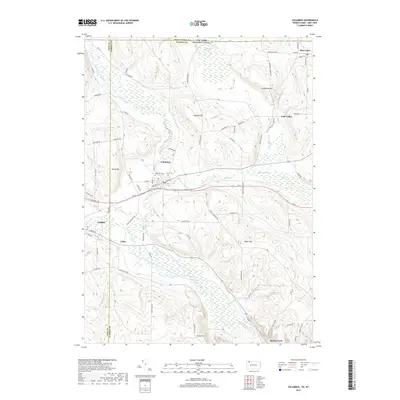
2019 Map of Columbus
USGS Topo · Published 2019About this map
Brokenstraw Creek and its many tributaries, including Coffee Creek and Hare Cr, define the drainage patterns of this border region where Erie and Warren Counties meet the New York state line. The settlement of Columbus sits at a central crossroads near the confluence of Coffee Cr and the main stem of the Brokenstraw, flanked by the Westlawn and Curtis cemeteries. The landscape is characterized by a mix of upland summits like Ingersoll Hill and Humphrey Hill and low-lying wetlands such as Benson Swamp and Tamarack Swamp. To the west, the outskirts of Corry appear, while smaller hamlets like Colza, Bear Lake, and Spring Creek are connected by a network of rural roads including Scotts Crossing Rd and Sample Flats Rd, reflecting the area's enduring agricultural and residential character.
Find a feature on this map
74 named features on this map. Tap any name to fly to it.
Don’t see what you’re looking for? This feature index may not catch every label — zoom into the map to look around manually.
Map Details
Editions of this 2019 Columbus Map
This is the sole edition of this map. No revisions or reprints were ever made.
Other maps of this area

1904 · Chautaqua
USGS Topo · 1:62,500

1905 · Clymer
USGS Topo · 1:62,500

1926 · Youngsville
USGS Topo · 1:62,500

1929 · Corry
USGS Topo · 1:48,000

1929 · Youngsville
USGS Topo · 1:62,500

1932 · Corry
USGS Topo · 1:62,500

1939 · Clymer
USGS Topo · 1:62,500

1941 · Chautauqua
USGS Topo · 1:62,500

1941 · Clymer
USGS Topo · 1:62,500

1943 · Youngsville
USGS Topo · 1:62,500