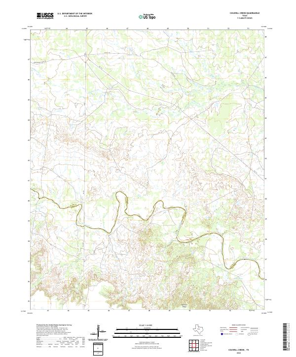
2022 Map of Colwell Creek
USGS Topo · Published 2022About this map
The North Wichita River snakes along the jurisdictional divide of Foard and Knox Counties, defining the drainage patterns of this rural Texas landscape. This terrain is characterized by dissected breaks and high points such as Ignorant Ridge, which rises above the surrounding plains. The local hydrology is further defined by ephemeral and perennial flows including Colwell Cr and S Beaver Cr, alongside the small basin of Kiowa Lake in the southeast. Ranching and transport infrastructure is represented by a network of rural routes such as Montgomery Ranch Rd and Halsell Rd, which connect the remote parcels of the Rolling Plains. The map provides a detailed view of the winding boundary between Foard and Knox counties, tracing the natural contours of the riverbed as it transitions through the cattle country of North Texas.
Find a feature on this map
11 named features on this map. Tap any name to fly to it.
Don’t see what you’re looking for? This feature index may not catch every label — zoom into the map to look around manually.
Map Details
Editions of this 2022 Colwell Creek Map
This is the sole edition of this map. No revisions or reprints were ever made.
Other maps of this area

1954 · Wichita Falls
USGS Topo · 1:250,000

1958 · Wichita Falls
USGS Topo · 1:250,000

1966 · Santa Rosa Lake SW
USGS Topo · 1:24,000

1966 · Soap Creek
USGS Topo · 1:24,000

1966 · Colwell Creek
USGS Topo · 1:24,000

1966 · Halsell Ranch
USGS Topo · 1:24,000

1966 · Gilliland
USGS Topo · 1:24,000

1966 · Crowell
USGS Topo · 1:24,000

1966 · Vera
USGS Topo · 1:24,000

1966 · Thalia
USGS Topo · 1:24,000