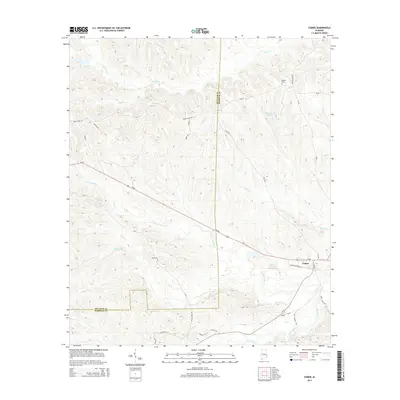
2014 Map of Comer
USGS Topo · Published 2014About this map
Comer sits along the southern rail line near the border of Bullock and Barbour counties, serving as a focal point for this rural landscape in the early 21st century. The terrain is defined by a dense network of hydrologic features, including the S Fork Cowikee Cr and the winding Johnson Cr to the southeast. The area is dotted with significant private water bodies such as McCains Lake, Wehle Lake, and the specifically named Grants Duck Pond, which suggest a land use pattern focused on recreation, conservation, or agricultural irrigation. Transportation in the region is anchored by Us-82, which cuts diagonally across the quadrangle, and a series of rural routes like Martin Creek Rd and Great Hope Rd that connect the scattered farmsteads and creek bottoms. These drainage systems, including Martin Cr and Norton Cr, create a deeply dissected topography typical of the East Gulf Coastal Plain.
Find a feature on this map
32 named features on this map. Tap any name to fly to it.
Don’t see what you’re looking for? This feature index may not catch every label — zoom into the map to look around manually.
Map Details
Editions of this 2014 Comer Map
This is the sole edition of this map. No revisions or reprints were ever made.
Other maps of this area

1953 · Dothan
USGS Topo · 1:250,000

1954 · Dothan
USGS Topo · 1:250,000

1955 · Dothan
USGS Topo · 1:250,000

1955 · Phenix City
USGS Topo · 1:250,000

1957 · Phenix City
USGS Topo · 1:250,000

1958 · Phenix City
USGS Topo · 1:250,000

1968 · White Oak
USGS Topo · 1:24,000

1968 · Clayton North
USGS Topo · 1:24,000

1968 · Mount Andrew
USGS Topo · 1:24,000
1973 · Batesville
USGS Topo · 1:24,000