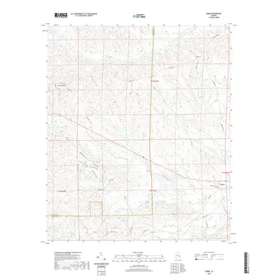
2020 Map of Comer
USGS Topo · Published 2020About this map
Comer anchors the eastern edge of this Alabama landscape, situated where the rolling uplands of Barbour County meet the intricate drainage systems of the S Fork Cowikee Cr. The terrain is defined by a dense network of waterways, including Bear Cr, Johnson Cr, and Martin Cr, which carved the winding ridges that dominate the topography. For genealogists and local historians, the map preserves the locations of Ramah Cem and Seay Cem, alongside numerous family-named landmarks like McCalls Pond and Grants Duck Pond.
Find a feature on this map
46 named features on this map. Tap any name to fly to it.
Don’t see what you’re looking for? This feature index may not catch every label — zoom into the map to look around manually.
Map Details
Editions of this 2020 Comer Map
This is the sole edition of this map. No revisions or reprints were ever made.
Other maps of this area

1953 · Dothan
USGS Topo · 1:250,000

1954 · Dothan
USGS Topo · 1:250,000

1955 · Dothan
USGS Topo · 1:250,000

1955 · Phenix City
USGS Topo · 1:250,000

1957 · Phenix City
USGS Topo · 1:250,000

1958 · Phenix City
USGS Topo · 1:250,000

1968 · White Oak
USGS Topo · 1:24,000

1968 · Clayton North
USGS Topo · 1:24,000

1968 · Mount Andrew
USGS Topo · 1:24,000
1973 · Batesville
USGS Topo · 1:24,000