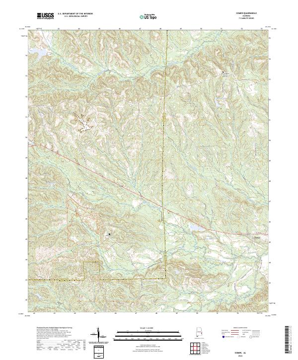
2024 Map of Comer
USGS Topo · Published 2024About this map
The Bullock Co Barbour Co boundary line bisects this portion of rural Alabama, where the settlement of Comer serves as a local landmark. The landscape is defined by the headwaters and tributaries of several prominent drainage systems, including South Fork Cowikee Creek, Bear Creek, and Norton Creek. These watercourses carve through the terrain alongside numerous man-made and natural impoundments like Grants Duck Pond and McCalls Pond.
Find a feature on this map
44 named features on this map. Tap any name to fly to it.
Don’t see what you’re looking for? This feature index may not catch every label — zoom into the map to look around manually.
Map Details
Editions of this 2024 Comer Map
This is the sole edition of this map. No revisions or reprints were ever made.
Other maps of this area

1953 · Dothan
USGS Topo · 1:250,000

1954 · Dothan
USGS Topo · 1:250,000

1955 · Dothan
USGS Topo · 1:250,000

1955 · Phenix City
USGS Topo · 1:250,000

1957 · Phenix City
USGS Topo · 1:250,000

1958 · Phenix City
USGS Topo · 1:250,000

1968 · White Oak
USGS Topo · 1:24,000

1968 · Clayton North
USGS Topo · 1:24,000

1968 · Mount Andrew
USGS Topo · 1:24,000
1973 · Batesville
USGS Topo · 1:24,000