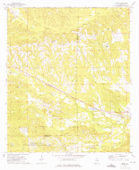
1973 Map of Comer
USGS Topo · Published 1975About this map
Comer sits at a crossroads in eastern Alabama during the early 1970s, serving as a focal point for the surrounding rural landscape where the Central of Georgia railroad line cuts a diagonal path across the terrain. The map reveals a community deeply rooted in its local institutions, with numerous country churches such as Great Hope Ch, Ramah Ch, and Pleasant Hill Ch scattered throughout the countryside alongside family landmarks like Seay Cem.
Find a feature on this map
19 named features on this map. Tap any name to fly to it.
Don’t see what you’re looking for? This feature index may not catch every label — zoom into the map to look around manually.
Map Details
Editions of this 1973 Comer Map
This is the sole edition of this map. No revisions or reprints were ever made.
Other maps of this area

1953 · Dothan
USGS Topo · 1:250,000

1954 · Dothan
USGS Topo · 1:250,000

1955 · Dothan
USGS Topo · 1:250,000

1955 · Phenix City
USGS Topo · 1:250,000

1957 · Phenix City
USGS Topo · 1:250,000

1958 · Phenix City
USGS Topo · 1:250,000

1968 · White Oak
USGS Topo · 1:24,000

1968 · Clayton North
USGS Topo · 1:24,000

1968 · Mount Andrew
USGS Topo · 1:24,000
1973 · Batesville
USGS Topo · 1:24,000