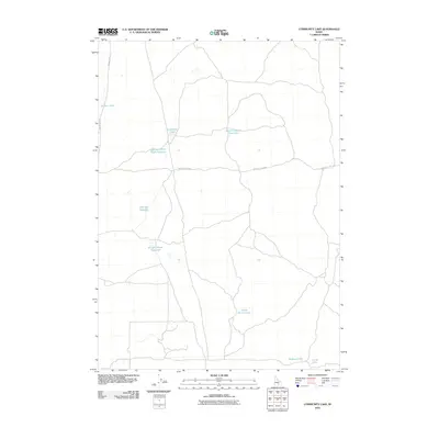
2010 Map of Community Lake
USGS Topo · Published 2010About this map
Community Lake sits at the center of this 2010 topographic survey of Minidoka County, serving as a primary landmark in a landscape defined by water management and volcanic geography. The terrain is characterized by a network of reservoirs and small lakes, including Kimama Marsh Reservoir and Flat Top Reservoir, which suggest the vital role of irrigation and drainage in this Idaho high desert environment. The presence of Kimama Cave Rd and Bear Trap Cave Rd provides clear evidence of the area's subterranean volcanic features, hinting at the lava tubes and caverns that lie beneath the surface. To the south, smaller water bodies such as Halfway Lake and Little Lake mark the edges of more developed agricultural lands, contrasting with the more open, feature-sparse northern sections of the quadrangle.
Find a feature on this map
11 named features on this map. Tap any name to fly to it.
Don’t see what you’re looking for? This feature index may not catch every label — zoom into the map to look around manually.
Map Details
Editions of this 2010 Community Lake Map
This is the sole edition of this map. No revisions or reprints were ever made.
Other maps of this area

1954 · Pocatello
USGS Topo · 1:250,000

1955 · Idaho Falls
USGS Topo · 1:250,000

1958 · Idaho Falls
USGS Topo · 1:250,000

1958 · Pocatello
USGS Topo · 1:250,000

1972 · Shale Butte
USGS Topo · 1:24,000

1972 · Kimama
USGS Topo · 1:24,000

1972 · Community Lake
USGS Topo · 1:24,000

1972 · Max
USGS Topo · 1:24,000

1972 · Laidlaw Lake
USGS Topo · 1:24,000

1972 · Bottleneck Lake
USGS Topo · 1:24,000