Old Maps of Lincoln County, Idaho
Explore 204 old maps of Lincoln County, spanning from 1954 to today. These high-resolution historic maps reveal how streets, neighborhoods, landmarks, and natural features evolved over time — perfect for genealogy, metal detecting, research, and local history exploration.
What you can do with these maps:
- See how Lincoln County changed over time: Compare historical maps to modern-day views to trace roads, homesites, rail lines & more.
- View detailed metadata: Each map includes creators, publishers, year, scale, and archive source.
- Overlay maps with satellite & LiDAR: Visualize the past alongside modern tools to explore terrain & human change.
- Trusted historical sources: Maps sourced from the USGS, Library of Congress, and other archives.
- Access maps your way: View online, download high-res files, or order prints for personal or research use.
Start exploring old maps of Lincoln County to uncover forgotten places, hidden landmarks, and the deep history beneath your feet.
Lincoln County, ID maps
(204)- 1954 Map of Pocatello, 1963 Print
 1954 Pocatello1963 Print · USGSSoutheast Idaho in the mid-1950s reveals a landscape shaped by massive water reclamation and mountain forests. Researchers can trace the development of the Fort Hall Indian Reservation or locate specific landmarks like the Arbon P O and Emerson School.4 unique versions available
 - 1955 Map of Idaho Falls, 1963 Print
 1955 Idaho Falls1963 Print · USGSThe Snake River Plain and its surrounding volcanic peaks are captured in the late fifties, showing the region's unique mix of nuclear research and high-desert ranching. Trace the industrial footprint of the National Reactor Testing Station or find old mining sites like Empire Mine.5 unique versions available
 - 1955 Map of Twin Falls, 1963 Print
 1955 Twin Falls1963 Print · USGSThe Magic Valley flourished in the mid-1950s as a sophisticated network of irrigation and rail lines connected high-desert outposts. Researchers can trace the engineering of the Milner-Gooding Canal, the remote Murphy Hot Springs, and the Union Pacific rail network.3 unique versions available
 - 1955 Map of Hailey, 1968 Print
 1955 Hailey1968 Print · USGSCentral Idaho in the mid-fifties reveals a landscape transitioning from deep-rooted silver mining to a burgeoning outdoor economy. Researchers can trace the legacy of the Union Pacific line, the remote Triumph Mine, and original airfield layouts at Mountain Home Air Force Base.4 unique versions available
 - 1957 Map of Thorn Creek SE, 1958 Print
 1957 Thorn Creek SE1958 Print · USGSThe Big Wood River valley at the Gooding and Lincoln county line shows a landscape of intensive irrigation in the late fifties. Genealogists and researchers can trace water rights and local landmarks like the Thorn Creek Sch, the Diversion Dam, and the High Line Canal.3 unique versions available
 - 1957 Map of Thorn Creek, 1959 Print
 1957 Thorn Creek1959 Print · USGSThe Bennett Hills of southern Idaho are captured here in the late fifties, showcasing a landscape of high-desert ranching and complex irrigation. Genealogists and local historians can locate the Thorn Creek School, trace the Milner Gooding Canal, and explore the geologically unique Little City of Rocks.2 unique versions available
 - 1958 Map of Twin Falls
 1958 Twin Falls1958 Print · USGSThe Magic Valley and Snake River Plain are captured here in the late fifties, showcasing a region defined by transformative irrigation projects and desert military ranges. Researchers can trace the Union Pacific rail lines and locate small outlying settlements like Wickahoney, Rogerson, and Hollister.2 unique versions available
 - 1958 Map of Idaho Falls
 1958 Idaho Falls1958 Print · USGSEastern Idaho in the late fifties showcases the rapid expansion of agricultural and scientific outposts across its volcanic plains. Researchers can locate remote sites like Atomic City, mineral interests at White Knob Mine, and the cultural grounds of St Marys Mission.2 unique versions available
 - 1958 Map of Pocatello
 1958 Pocatello1958 Print · USGSSoutheastern Idaho in the late fifties was a landscape of expanding reservoirs and historic trails. Genealogists and historians can trace the Old Oregon Trail, locate the Bannock Creek Indian Day School, and study the many Union Pacific rail sidings.2 unique versions available
 - 1959 Map of Hailey
 1959 Hailey1959 Print · USGSThe Sawtooth range and high desert plains of Southern Idaho are captured here during a period of mining and military growth. Genealogists and historians can locate mining sites like Triumph Mine, early settlements such as Idaho City, and the Mountain Home Air Force Base.2 unique versions available
 - 1962 Map of Hailey
 1962 Hailey1962 Print · USGSCentral Idaho in the early sixties showcases a landscape of high-altitude ranching and mining at the foot of the Sawtooth Mountains. Genealogists and historians can trace the rail-and-river economy through the Union Pacific Railroad corridor and explore old mining sites like the Triumph Mine or Silver Star Queens Mine.
 - 1971 Map of Shoshone SE, 1973 Print
 1971 Shoshone SE1973 Print · USGSIrrigation and excavation define this section of the Magic Valley in the early seventies. Genealogists and researchers can trace water rights and land use through the Milner Gooding Canal, various Lateral channels, and several Borrow Pits.2 unique versions available
 - 1971 Map of Star Lake, 1973 Print
 1971 Star Lake1973 Print · USGSThe high desert of south-central Idaho in the early seventies shows a landscape transformed by water management and ranching. Trace the network of irrigation laterals and remote reservoirs like Rabbit Lake Reservoir or locate the significant Wilson Butte Cave.2 unique versions available
 - 1971 Map of Owinza, 1974 Print
 1971 Owinza1974 Print · USGSLincoln County in the early seventies is a landscape of high-desert ranching and rail infrastructure centered on the Union Pacific line. Researchers can trace remote water improvements like Shirley G Spring, Banner Reservoir, and the Dietrich Allotment Well.2 unique versions available
 - 1971 Map of Dietrich, 1974 Print
 1971 Dietrich1974 Print · USGSDietrich and the surrounding Idaho lava fields are captured in the early 1970s as a hub of railroad transport and irrigation. Researchers can trace the sophisticated water network of the Milner Gooding Canal alongside the Union Pacific line and Crater Butte.2 unique versions available
 - 1971 Map of Tunupa, 1974 Print
 1971 Tunupa1974 Print · USGSSouthern Idaho's volcanic plains are captured here in the early 1970s at the intersection of Gooding and Lincoln counties. Genealogists and researchers can trace the path of the Union Pacific through the settlement of Tunupa and the vital South Gooding Main Canal.2 unique versions available
 - 1971 Map of Gooding SE, 1974 Print
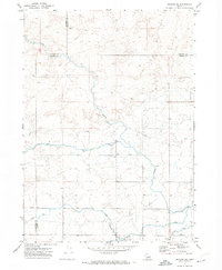 1971 Gooding SE1974 Print · USGSThe intersection of Gooding, Jerome, and Lincoln Counties is shown in the early 1970s as a landscape of irrigation and desert tracks. Researchers can trace the water-management network through the Diversion Dam and Siphon, or follow remote Jeep Trails across the flats.2 unique versions available
 - 1971 Map of Shoshone SW, 1974 Print
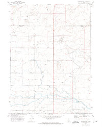 1971 Shoshone SW1974 Print · USGSSouthern Idaho's irrigated high desert is captured here in the early seventies along the border of Lincoln and Jerome counties. Genealogists and historians can trace water management infrastructure and land use through the North Side Main Canal and the Bacon Reservoir Ranch.2 unique versions available
 - 1971 Map of Dietrich Butte, 1974 Print
 1971 Dietrich Butte1974 Print · USGSThe volcanic plains of Lincoln County come into focus in the early 1970s, showcasing a landscape defined by desert irrigation and the railroad. Genealogists and historians can trace the Union Pacific through Besslen or locate water landmarks like Trout Waterhole and Ruiz Lake.2 unique versions available
 - 1971 Map of Owinza Butte, 1974 Print
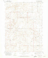 1971 Owinza Butte1974 Print · USGSThe high desert of the Lincoln and Jerome county border is mapped here during the early seventies. Researchers can trace remote water sources and ranching landmarks like Owinza Butte Lake, Stage Barn Well, and the oddly named One Shot Lake.2 unique versions available
 - 1971 Map of Shoshone, 1974 Print
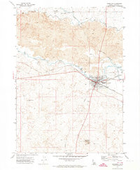 1971 Shoshone1974 Print · USGSShoshone flourished as a high-desert railroad and irrigation hub in the early seventies, where the Big and Little Wood Rivers meet. Trace the path of the Union Pacific and vital water works like the MILNER GOODING CANAL and the Diversion Dam.3 unique versions available
 - 1972 Map of Shale Butte, 1976 Print
 1972 Shale Butte1976 Print · USGSLincoln County’s volcanic rangelands are documented here in the early seventies, showing a landscape defined by basalt flows and remote outposts. Researchers can locate the Shale Butte Trappers Cabin and trace livestock paths past Mustard Lake and Shale Butte Lake.
 - 1972 Map of Kimama, 1976 Print
 1972 Kimama1976 Print · USGSKimama and the surrounding Snake River Plain come alive in this early 1970s survey of the Lincoln and Minidoka county line. Researchers can trace the diagonal path of the Union Pacific railroad and locate water infrastructure like the Siphon and Sage Lake.
 - 1972 Map of Kimama Butte, 1976 Print
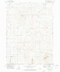 1972 Kimama Butte1976 Print · USGSIn the early 1970s, the high desert of southern Idaho remained a landscape of volcanic buttes and critical water management. Researchers can locate remote features like Kimama Butte Cave, the Kimama Butte Lookout Radio Tower, and Sid Reservoir.
 - 1972 Map of Community Lake, 1976 Print
 1972 Community Lake1976 Print · USGSThe high desert border of Lincoln and Minidoka counties comes into focus in the early 1970s. Researchers can trace the development of vital water infrastructure through named features like the Kimama Marsh Reservoir, Peavey Well, and Community Lake.
Showing maps 1-25 of 204
Top cities of Lincoln County
Frequently asked questions
- What are the different types of historical maps available for Lincoln County?
- What is the oldest map of Lincoln County?
- Where can I purchase historical maps of Lincoln County for my home or office?
- Where can I download high-res historical maps of Lincoln County?
- Are there historical topographic maps available for Lincoln County?
- Is there historical aerial imagery available for Lincoln County?
- Where are historical maps of Lincoln County sourced from?