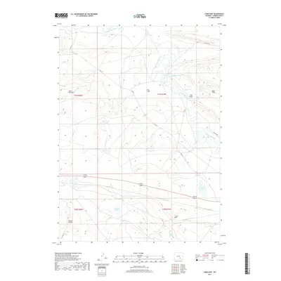
2017 Map of Como East
USGS Topo · Published 2017About this map
Medicine Bow River and its tributary, the Little Medicine Bow River, define the hydrology of this high-plains landscape in Carbon County. The map details a series of basins and alkaline water bodies, including Como Lake, Allen Lake, and Pynchin Lake, which are characteristic of this semi-arid region. These lakes sit amidst prominent geologic formations such as Fossil Ridge and Slate Ridge, providing clear topographic context for the local landform structures.
Find a feature on this map
22 named features on this map. Tap any name to fly to it.
Don’t see what you’re looking for? This feature index may not catch every label — zoom into the map to look around manually.
Map Details
Editions of this 2017 Como East Map
This is the sole edition of this map. No revisions or reprints were ever made.
Other maps of this area

1914 · Saddleback Hills
USGS Topo · 1:62,500

1915 · Como Ridge
USGS Topo · 1:48,000

1918 · Como Ridge
USGS Topo · 1:62,500

1921 · Saddleback Hills
USGS Topo · 1:62,500

1954 · Rawlins
USGS Topo · 1:250,000

1955 · Casper
USGS Topo · 1:250,000

1958 · Rawlins
USGS Topo · 1:250,000

1958 · Casper
USGS Topo · 1:250,000

1961 · T B Ranch
USGS Topo · 1:24,000
1961 · Windy Hill
USGS Topo · 1:24,000