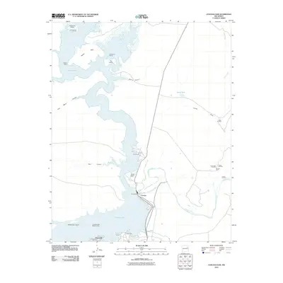
2010 Map of Conchas Dam
USGS Topo · Published 2010About this map
Conchas Dam stands as the central landmark of this landscape, impounding the Canadian River to form the expansive Conchas Lake. The surrounding terrain is a complex of mesas and canyons, including the prominent Aguilar Mesa and several inlets like Graveyard Pocket and Boot Canyon. Human settlement is concentrated around the water's edge at Hooverville and the community of Conchas, which is supported by infrastructure like the Conchas Dam Post Office and docks.
Find a feature on this map
29 named features on this map. Tap any name to fly to it.
Don’t see what you’re looking for? This feature index may not catch every label — zoom into the map to look around manually.
Map Details
Editions of this 2010 Conchas Dam Map
This is the sole edition of this map. No revisions or reprints were ever made.
Other maps of this area

1954 · Santa Fe
USGS Topo · 1:250,000

1958 · Santa Fe
USGS Topo · 1:250,000

1967 · Tenaja Mesa
USGS Topo · 1:24,000

1967 · Monument Point
USGS Topo · 1:24,000

1968 · La Cinta Mesa
USGS Topo · 1:24,000

1968 · Conchas Dam
USGS Topo · 1:24,000
1972 · Bell Ranch
USGS Topo · 1:24,000

1972 · Four V Ranch
USGS Topo · 1:24,000
1972 · Bookout Ranch
USGS Topo · 1:24,000

1972 · Wade Canyon
USGS Topo · 1:24,000