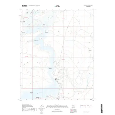
2020 Map of Conchas Dam
USGS Topo · Published 2020About this map
Conchas Dam anchors this high-desert landscape in San Miguel County, where the impounded waters of the Canadian River form the sprawling reaches of Conchas Lake. The irregular shoreline creates numerous named points and islands, including Cedar Point, Rattlesnake Island, and Campers Island. For genealogists and local historians, the presence of the Alamosa Plaza Cem near Graveyard Pocket and the La Cinta Cem to the east offer evidence of the area's early ranching and settlement history. The landscape is defined by mesas and canyons, from Minese Mesa in the north to the winding Jose Maria Canyon. Irrigation infrastructure is represented by the Bell Ranch Canal, while the small settlement of Hooverville sits at the southern edge of the lake near Lodge Rd, serving as a focal point for activity at the reservoir.
Find a feature on this map
32 named features on this map. Tap any name to fly to it.
Don’t see what you’re looking for? This feature index may not catch every label — zoom into the map to look around manually.
Map Details
Editions of this 2020 Conchas Dam Map
This is the sole edition of this map. No revisions or reprints were ever made.
Other maps of this area

1954 · Santa Fe
USGS Topo · 1:250,000

1958 · Santa Fe
USGS Topo · 1:250,000

1967 · Tenaja Mesa
USGS Topo · 1:24,000

1967 · Monument Point
USGS Topo · 1:24,000

1968 · La Cinta Mesa
USGS Topo · 1:24,000

1968 · Conchas Dam
USGS Topo · 1:24,000
1972 · Bell Ranch
USGS Topo · 1:24,000

1972 · Four V Ranch
USGS Topo · 1:24,000
1972 · Bookout Ranch
USGS Topo · 1:24,000

1972 · Wade Canyon
USGS Topo · 1:24,000