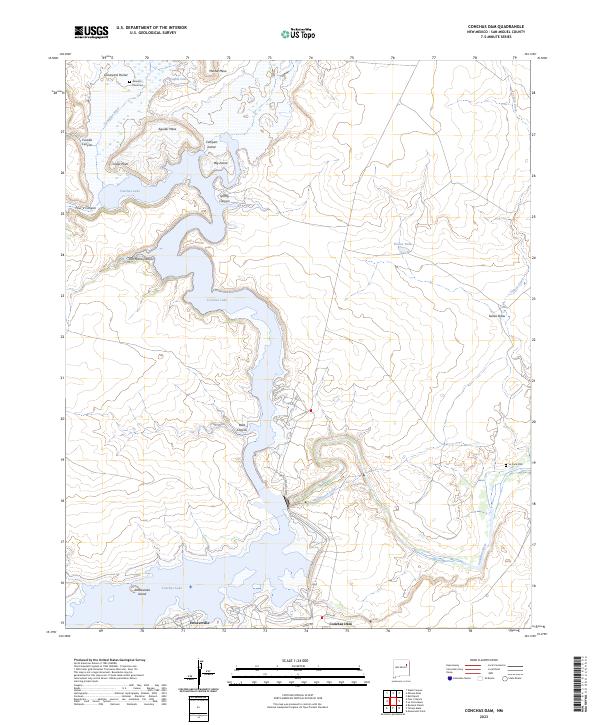
2023 Map of Conchas Dam
USGS Topo · Published 2023About this map
Conchas Lake dominates this San Miguel County landscape, where the impounded waters of the Canadian River reach into numerous canyons and draws. This modern survey illustrates the complex geography of the reservoir's shoreline, from the wide expanses near Rattlesnake Island to the narrow reaches of Jose Maria Canyon and Boot Canyon. The settlement of Conchas Dam and the nearby community of Hooverville serve as primary points of activity, connected by local routes like State Hwy 433 and Lodge Rd. High mesas such as Minese Mesa and Aguilar Mesa provide significant topographic relief above the water level. For those researching local heritage, the map identifies small, isolated burial sites including Alamosa Plaza Cem to the north and La Cinta Cem to the southeast, alongside the managed water flow of the Bell Ranch Canal.
Find a feature on this map
34 named features on this map. Tap any name to fly to it.
Don’t see what you’re looking for? This feature index may not catch every label — zoom into the map to look around manually.
Map Details
Editions of this 2023 Conchas Dam Map
This is the sole edition of this map. No revisions or reprints were ever made.
Other maps of this area

1954 · Santa Fe
USGS Topo · 1:250,000

1958 · Santa Fe
USGS Topo · 1:250,000

1967 · Tenaja Mesa
USGS Topo · 1:24,000

1967 · Monument Point
USGS Topo · 1:24,000

1968 · La Cinta Mesa
USGS Topo · 1:24,000

1968 · Conchas Dam
USGS Topo · 1:24,000
1972 · Bell Ranch
USGS Topo · 1:24,000

1972 · Four V Ranch
USGS Topo · 1:24,000
1972 · Bookout Ranch
USGS Topo · 1:24,000

1972 · Wade Canyon
USGS Topo · 1:24,000