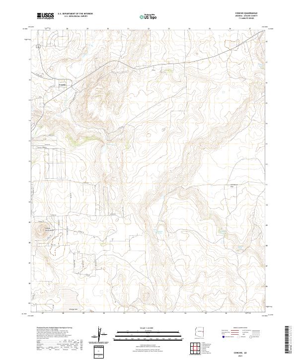
2021 Map of Concho
USGS Topo · Published 2021About this map
Concho serves as the focal point of this modern topographic survey, situated in the arid high country of Apache County. The settlement and the nearby Concho Spring Knoll are defined by a network of local roads such as Snake Ranch Rd and Ranch Dr, reflecting the residential and agricultural layout of the area. The landscape is characterized by its vital water sources, with numerous springs punctuating the terrain, including Ortega Spring, Malpais Spring, and Hamblin Spring.
Find a feature on this map
43 named features on this map. Tap any name to fly to it.
Don’t see what you’re looking for? This feature index may not catch every label — zoom into the map to look around manually.
Map Details
Editions of this 2021 Concho Map
This is the sole edition of this map. No revisions or reprints were ever made.
Other maps of this area

1886 · St Johns
USGS Topo · 1:250,000

1892 · St Johns
USGS Topo · 1:250,000

1954 · Saint Johns
USGS Topo · 1:250,000

1955 · Adamana 4 SW
USGS Topo · 1:24,000

1955 · Adamana 4 SE
USGS Topo · 1:24,000

1955 · Wolford Springs 3 SW
USGS Topo · 1:24,000

1955 · Hunt
USGS Topo · 1:62,500

1957 · Saint Johns
USGS Topo · 1:250,000

1958 · Saint Johns
USGS Topo · 1:250,000

1962 · Saint Johns
USGS Topo · 1:250,000