
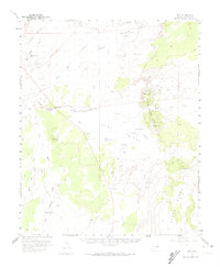
1955 Map of Hunt
USGS Topo · Published 1959About this map
The confluence of the Little Colorado River and the Zuni River defines this high-desert landscape in northern Apache County. In the mid-1950s, the small settlement of Hunt served as a focal point for the surrounding ranching and dry-farming activities, situated along the path of U.S. Route 260. The map documents a network of isolated homesteads and landmarks like the Greer Place and the Old Mail Station, the latter hinting at the historic transport routes that once crossed this territory.
Find a feature on this map
44 named features on this map. Tap any name to fly to it.
Don’t see what you’re looking for? This feature index may not catch every label — zoom into the map to look around manually.
Map Details
Editions of this 1955 Hunt Map
2 editions found
Other maps of this area

1886 · St Johns
USGS Topo · 1:250,000

1892 · St Johns
USGS Topo · 1:250,000

1912 · Petrified Forest
USGS Topo · 1:62,500

1954 · Saint Johns
USGS Topo · 1:250,000

1955 · Petrified Forest
USGS Topo · 1:62,500

1955 · Adamana 1 SW
USGS Topo · 1:24,000

1955 · Adamana 3 NE
USGS Topo · 1:24,000

1955 · Adamana 4 SW
USGS Topo · 1:24,000

1955 · Adamana 4 NE
USGS Topo · 1:24,000

1955 · Adamana 4 NW
USGS Topo · 1:24,000