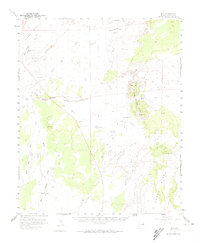
1955 Map of Hunt
USGS Topo · Published 1974About this map
The Little Colorado River and Zuni River converge in this high-desert landscape of Apache County, where water sources dictated the patterns of early settlement and transportation. Evidence of the region's historical transit is marked by the Old Mail Station, situated along the western draws that lead toward the river valley. The small community of Hunt sits at a central crossing, supported by neighboring outposts like the Hutchinson Ranch and Greer Place. The terrain is defined by dramatic volcanic features and mesas, including the prominent Potter Mesa to the north and the dark basaltic expanse of Black Ridge in the south. Notable alkaline and seasonal water bodies such as Soda Lake and Stinking Springs provide distinct landmarks among the various washes like Beaver Dam Wash and Surprise Creek, illustrating the complex hydrology of the Colorado Plateau in the mid-1950s.
Find a feature on this map
41 named features on this map. Tap any name to fly to it.
Don’t see what you’re looking for? This feature index may not catch every label — zoom into the map to look around manually.
Map Details
Editions of this 1955 Hunt Map
2 editions found

Other maps of this area

1886 · St Johns
USGS Topo · 1:250,000

1892 · St Johns
USGS Topo · 1:250,000

1912 · Petrified Forest
USGS Topo · 1:62,500

1954 · Saint Johns
USGS Topo · 1:250,000

1955 · Petrified Forest
USGS Topo · 1:62,500

1955 · Adamana 1 SW
USGS Topo · 1:24,000

1955 · Adamana 3 NE
USGS Topo · 1:24,000

1955 · Adamana 4 SW
USGS Topo · 1:24,000

1955 · Adamana 4 NE
USGS Topo · 1:24,000

1955 · Adamana 4 NW
USGS Topo · 1:24,000