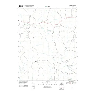
2010 Map of Concord
USGS Topo · Published 2010About this map
Concord and the surrounding Campbell County countryside are documented here in 2010, showing a landscape defined by small settlements and an intricate network of rural routes. The village of Spout Spring sits along the primary highway, while Sherwill marks a junction to the south. The area's geography is anchored by Pilot Mountain, with a significant watershed feeding into the Falling River and its various forks and branches. Water management is a visible priority, with numerous impoundments such as Townwanda Lake, Phoebe Lake, and Gala Lake dotting the terrain.
Find a feature on this map
45 named features on this map. Tap any name to fly to it.
Don’t see what you’re looking for? This feature index may not catch every label — zoom into the map to look around manually.
Map Details
Editions of this 2010 Concord Map
This is the sole edition of this map. No revisions or reprints were ever made.
Other maps of this area

1892 · Lynchburg
USGS Topo · 1:125,000

1892 · Appomattox
USGS Topo · 1:125,000

1944 · Lynchburg
USGS Topo · 1:62,500

1947 · Roanoke
USGS Topo · 1:250,000

1950 · Lynchburg
USGS Topo · 1:62,500

1956 · Brookneal
USGS Topo · 1:62,500

1956 · Gladys
USGS Topo · 1:62,500

1958 · Appomattox
USGS Topo · 1:62,500

1959 · Roanoke
USGS Topo · 1:250,000

1963 · Roanoke
USGS Topo · 1:250,000