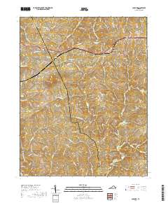
2019 Map of Concord
USGS Topo · Published 2019About this map
The boundary line between Campbell Co and Appomattox Co bisects this landscape, separating the community of Concord from Spout Spring and Sherwill. This region is defined by a dense network of watercourses, including Falling River, Wreck Island Cr, and Reedy Cr, which carve through the Piedmont terrain toward the Fork Falling River. Significant landmarks such as Pilot Mtn provide a vertical contrast to the many basins holding local water bodies like Concord Lake, Phoebe Lake, and Gald Lake. The local infrastructure is shaped by the CSX Transportation rail line and numerous named farm roads. Genealogists and local historians can locate long-standing landmarks including the Concord Cem and New Chapel, alongside family-named roads like Spring Mill Rd and Nowlins Mill Rd that hint at the area's agricultural and milling history.
Find a feature on this map
93 named features on this map. Tap any name to fly to it.
Don’t see what you’re looking for? This feature index may not catch every label — zoom into the map to look around manually.
Map Details
Editions of this 2019 Concord Map
This is the sole edition of this map. No revisions or reprints were ever made.
Other maps of this area

1892 · Lynchburg
USGS Topo · 1:125,000

1892 · Appomattox
USGS Topo · 1:125,000

1944 · Lynchburg
USGS Topo · 1:62,500

1947 · Roanoke
USGS Topo · 1:250,000

1950 · Lynchburg
USGS Topo · 1:62,500

1956 · Brookneal
USGS Topo · 1:62,500

1956 · Gladys
USGS Topo · 1:62,500

1958 · Appomattox
USGS Topo · 1:62,500

1959 · Roanoke
USGS Topo · 1:250,000

1963 · Roanoke
USGS Topo · 1:250,000