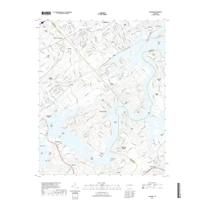
2019 Map of Concord
USGS Topo · Published 2019About this map
Fort Loudoun Lake and the winding Tennessee River dominate the landscape between the boundaries of Knox, Loudon, and Blount Counties. This modern survey illustrates the complex aquatic geography of the region, where the reservoir waters meet historical shoals like Turkey Creek Shoals and Choto Shoals. The transition from suburban development in Farragut to the more rural stretches near Antioch and Unitia highlights the varied topography of East Tennessee, from the heights of Blackoak Ridge to the low-lying Hines Valley.
Find a feature on this map
73 named features on this map. Tap any name to fly to it.
Don’t see what you’re looking for? This feature index may not catch every label — zoom into the map to look around manually.
Map Details
Editions of this 2019 Concord Map
This is the sole edition of this map. No revisions or reprints were ever made.
Other maps of this area

1895 · Loudon
USGS Topo · 1:125,000

1935 · Binfield
USGS Topo · 1:24,000

1935 · Meadow
USGS Topo · 1:24,000

1935 · Lenoir City
USGS Topo · 1:24,000

1935 · Bethel Valley
USGS Topo · 1:24,000

1935 · Bearden
USGS Topo · 1:24,000

1935 · Lovell
USGS Topo · 1:24,000

1936 · Louisville
USGS Topo · 1:24,000

1936 · Friendship
USGS Topo · 1:48,000

1936 · Loudon
USGS Topo · 1:24,000