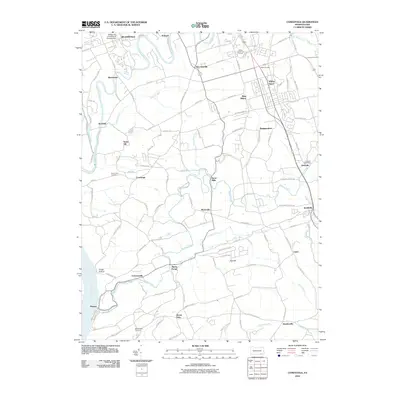
2010 Map of Conestoga
USGS Topo · Published 2010About this map
The Conestoga River and Little Conestoga Creek converge in this corner of Lancaster County, where the historic campus of Millersville University of Pennsylvania borders the northern edge of the survey. The landscape is a mix of long-established farming communities and the growing residential corridors of Willow Street and West Willow. Historically significant sites like Martic Forge and Burnt Mills are documented along the winding path of Pequea Creek, while the southwestern corner follows the Susquehanna River shoreline near Pequea. Small crossroad settlements like New Danville and Marticville remain central to the local road network, which includes ancestral family routes like Hans Herr Dr and Byerland Church Rd. Genealogical data is preserved through landmarks like Mount Zion Cemetery and Mount Nebo Cemetery, offering a detailed view of the rural and suburban transition during the early 21st century.
Find a feature on this map
111 named features on this map. Tap any name to fly to it.
Don’t see what you’re looking for? This feature index may not catch every label — zoom into the map to look around manually.
Map Details
Editions of this 2010 Conestoga Map
This is the sole edition of this map. No revisions or reprints were ever made.
Other maps of this area

1902 · Lancaster
USGS Topo · 1:62,500

1904 · Lancaster
USGS Topo · 1:62,500

1906 · New Holland
USGS Topo · 1:62,500

1908 · New Holland
USGS Topo · 1:62,500

1912 · Quarryville
USGS Topo · 1:62,500

1912 · Mc Calls Ferry
USGS Topo · 1:62,500

1941 · New Holland
USGS Topo · 1:62,500

1943 · Lancaster
USGS Topo · 1:62,500

1943 · Quarryville
USGS Topo · 1:62,500

1943 · Mc Calls Ferry
USGS Topo · 1:62,500
Featured Places
- West Lampeter Township, PA
- Willow Street, West Lampeter Township
- Millersville, PA
- Pequea, Conestoga Township
- Conestoga Township, PA