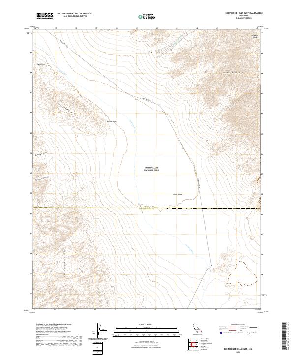
2021 Map of Confidence Hills East
USGS Topo · Published 2021About this map
Death Valley National Park encompasses a stark landscape of extreme elevation changes where the Amargosa River cuts through the desert floor. This 2021 survey details the convergence of major geographic features, including the Confidence Hills and the southern reaches of the Black Mountains. The arid corridor of Death Valley is framed by the Amargosa Range to the east and the Owlshead Mountains to the southwest, illustrating the complex basin-and-range topography. Historical transit through this unforgiving terrain is marked by Harry Wade Road, which skirts the edge of the Mojave Desert. Notable geological features such as The Narrows, Granite Canyon, and Confidence Wash highlight the intermittent water courses that have sculpted the landscape over millennia.
Find a feature on this map
19 named features on this map. Tap any name to fly to it.
Don’t see what you’re looking for? This feature index may not catch every label — zoom into the map to look around manually.
Map Details
Editions of this 2021 Confidence Hills East Map
This is the sole edition of this map. No revisions or reprints were ever made.
Other maps of this area

1933 · Avawatz Mountains
USGS Topo · 1:250,000

1947 · Trona
USGS Topo · 1:250,000

1948 · Trona
USGS Topo · 1:250,000

1948 · Leach Lake
USGS Topo · 1:62,500

1948 · Avawatz Pass
USGS Topo · 1:62,500

1950 · Confidence Hills
USGS Topo · 1:62,500

1951 · Avawatz Pass
USGS Topo · 1:62,500
1951 · Leach Lake
USGS Topo · 1:62,500

1951 · Shoshone
USGS Topo · 1:62,500

1953 · Trona
USGS Topo · 1:250,000