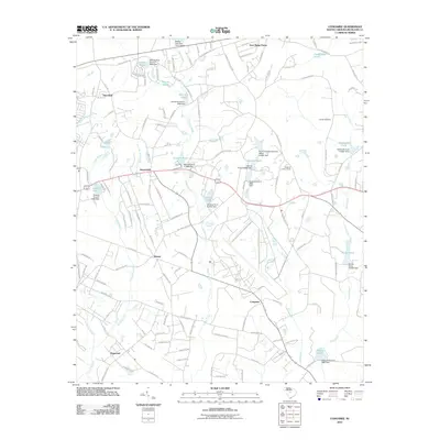
2011 Map of Congaree
USGS Topo · Published 2011About this map
Logues Cemetery and the elevated Eastover Lookout Tower anchor this Richland County landscape, where rural communities are defined by an intricate network of creeks and small impoundments. The terrain is a mosaic of family-named water features like Jordans Pond, Morrells Pond, and Haithcock Pond, many of which are regulated by numbered dams. This hydrological pattern suggests a history of local land management and agricultural water use across the drainage basins of Cedar Creek and Toms Creek.
Find a feature on this map
123 named features on this map. Tap any name to fly to it.
Don’t see what you’re looking for? This feature index may not catch every label — zoom into the map to look around manually.
Map Details
Editions of this 2011 Congaree Map
This is the sole edition of this map. No revisions or reprints were ever made.
Other maps of this area

1935 · Killian
USGS Topo · 1:48,000

1937 · Killian
USGS Topo · 1:62,500

1938 · Hagood
USGS Topo · 1:62,500

1941 · Spartanburg
USGS Topo · 1:250,000

1942 · Camden
USGS Topo · 1:125,000

1943 · Eastover
USGS Topo · 1:62,500

1948 · Hopkins
USGS Topo · 1:62,500

1953 · Messers Pond
USGS Topo · 1:24,000

1953 · Saylors Lake
USGS Topo · 1:24,000

1953 · Fort Jackson South
USGS Topo · 1:24,000