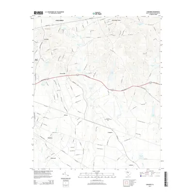
2014 Map of Congaree
USGS Topo · Published 2014About this map
Mc Entire Joint National Guard Base dominates the central portion of this landscape southeast of Columbia, showing the integration of military infrastructure within the rural fabric of Richland County. The map details a transition from the developing residential pockets of Swandale and Quail Creek in the northwest to the agricultural and natural wetlands of the south. Water is a defining element here, with numerous family-named impoundments such as Harmons Pond, Jordans Pond, and Westons Pond feeding into the drainage networks of Cedar Cr and Toms Cr. These features, alongside the Logues Cem, offer researchers a clear view of local land use and genealogy. The transport network is anchored by Garners Ferry Rd and Congaree Rd, connecting the scattered communities of Hopkins, Congaree, and Gadsden across a terrain defined by subtle elevation changes and expansive creek bottoms.
Find a feature on this map
44 named features on this map. Tap any name to fly to it.
Don’t see what you’re looking for? This feature index may not catch every label — zoom into the map to look around manually.
Map Details
Editions of this 2014 Congaree Map
This is the sole edition of this map. No revisions or reprints were ever made.
Other maps of this area

1935 · Killian
USGS Topo · 1:48,000

1937 · Killian
USGS Topo · 1:62,500

1938 · Hagood
USGS Topo · 1:62,500

1941 · Spartanburg
USGS Topo · 1:250,000

1942 · Camden
USGS Topo · 1:125,000

1943 · Eastover
USGS Topo · 1:62,500

1948 · Hopkins
USGS Topo · 1:62,500

1953 · Messers Pond
USGS Topo · 1:24,000

1953 · Saylors Lake
USGS Topo · 1:24,000

1953 · Fort Jackson South
USGS Topo · 1:24,000