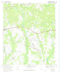
1972 Map of Congaree
USGS Topo · Published 1974About this map
Mc Entire Air National Guard Base dominates the central landscape of this Richland County region, positioned between the extensive Fort Jackson Military Reservation to the north and the rural settlement of Congaree. The 1970s era geography shows a transition from agricultural land to institutional and military use, evidenced by the proximity of Lower Richland High Sch and the Lower Richland Vocational Center to the airfield.
Find a feature on this map
52 named features on this map. Tap any name to fly to it.
Don’t see what you’re looking for? This feature index may not catch every label — zoom into the map to look around manually.
Map Details
Editions of this 1972 Congaree Map
3 editions found
Other maps of this area

1935 · Killian
USGS Topo · 1:48,000

1937 · Killian
USGS Topo · 1:62,500

1938 · Hagood
USGS Topo · 1:62,500

1941 · Spartanburg
USGS Topo · 1:250,000

1942 · Camden
USGS Topo · 1:125,000

1943 · Eastover
USGS Topo · 1:62,500

1948 · Hopkins
USGS Topo · 1:62,500

1953 · Messers Pond
USGS Topo · 1:24,000

1953 · Saylors Lake
USGS Topo · 1:24,000

1953 · Fort Jackson South
USGS Topo · 1:24,000