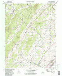
1994 Map of Conicville
USGS Topo · Published 1997About this map
Conicville lies at the heart of this Shenandoah Valley landscape, situated where Swover Creek and Mumaw Hill Creek descend from the ridges. The settlement pattern reflects the agricultural and industrial history of the region, featuring a dense network of country churches like St Johns Ch, Otterbein Chapel, and Grace Ch. To the northeast, the Old Iron Furnace near Columbia Furnace points to early rural industry, while the Confederate Unknown Memorial Cem in the southeast near Mt Jackson preserves local Civil War heritage.
Find a feature on this map
49 named features on this map. Tap any name to fly to it.
Don’t see what you’re looking for? This feature index may not catch every label — zoom into the map to look around manually.
Map Details
Editions of this 1994 Conicville Map
This is the sole edition of this map. No revisions or reprints were ever made.
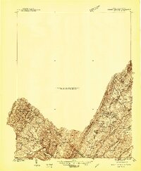
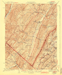
Other maps of this area

1892 · Woodstock
USGS Topo · 1:125,000

1921 · Orkney Springs
USGS Topo · 1:48,000

1923 · Orkney Springs
USGS Topo · 1:62,500

1923 · Edinburg
USGS Topo · 1:62,500
1940 · Orkney Springs
USGS Topo · 1:48,000

1942 · Mt Jackson
USGS Topo · 1:62,500
1943 · Orkney Springs
USGS Topo · 1:62,500

1944 · Orkney Springs
USGS Topo · 1:62,500

1946 · Mt Jackson
USGS Topo · 1:62,500

1947 · Mt Jackson
USGS Topo · 1:62,500