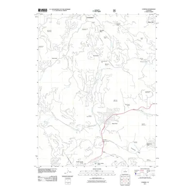
2011 Map of Conifer
USGS Topo · Published 2011About this map
Aspen Park and Conifer serve as central nodes for this 2011 survey of the Front Range foothills, where residential developments like Broken Arrow Acres and Green Valley Acres follow the winding course of North Turkey Creek. The landscape is a complex intersection of recreation, early industrial extraction, and rural community life. Evidence of historical mining remains visible through the Augusta Mine and the Evergreen Fluorite Deposit Mine to the north, while local civic foundations are represented by the Wild Rose Grange and Pleasant Park Grange. The transportation network relies on corridors like S Hwy 73 and S Turkey Creek Rd, which link the various mesas and gulches. Small-scale aviation is a notable feature of the area, evidenced by the Marshdale Stolport, Meyer Ranch Airport, and Flying J Ranch Airport, reflecting the unique logistical needs of this elevated terrain.
Find a feature on this map
131 named features on this map. Tap any name to fly to it.
Don’t see what you’re looking for? This feature index may not catch every label — zoom into the map to look around manually.
Map Details
Editions of this 2011 Conifer Map
This is the sole edition of this map. No revisions or reprints were ever made.
Other maps of this area

1893 · Platte Canyon
USGS Topo · 1:125,000

1899 · West Denver
USGS Topo · 1:125,000

1938 · Morrison
USGS Topo · 1:24,000

1942 · Morrison
USGS Topo · 1:31,680

1945 · Indian Hills
USGS Topo · 1:31,680

1945 · Platte Canyon
USGS Topo · 1:24,000

1945 · Pine
USGS Topo · 1:24,000

1945 · Bailey
USGS Topo · 1:24,000
1947 · Morrison
USGS Topo · 1:31,680

1948 · Pine
USGS Topo · 1:24,000