
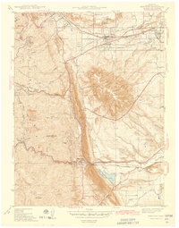
1942 Map of Morrison
USGS Topo · Published 1942About this map
The dramatic Hogback ridge dominates this Jefferson County landscape, creating a natural barrier between the mountain foothills and the expanding Denver plain. In 1938, when this area was surveyed by agencies including the Works Projects Administration, the region was a mix of academic institutions, military grounds, and early recreational sites. The Colorado School of Mines anchors the northern edge near Golden, while the State Military Reservation Camp George West occupies a significant tract to the east.
Find a feature on this map
51 named features on this map. Tap any name to fly to it.
Don’t see what you’re looking for? This feature index may not catch every label — zoom into the map to look around manually.
Map Details
Editions of this 1942 Morrison Map
2 editions found
Other maps of this area

1899 · West Denver
USGS Topo · 1:125,000

1906 · Blackhawk
USGS Topo · 1:62,500

1938 · Morrison
USGS Topo · 1:24,000

1939 · Golden
USGS Topo · 1:24,000

1941 · Arvada
USGS Topo · 1:31,680

1941 · Fort Logan
USGS Topo · 1:31,680

1942 · Golden
USGS Topo · 1:31,680

1942 · Littleton
USGS Topo · 1:31,680

1942 · Ralston Buttes
USGS Topo · 1:24,000
1944 · Arvada
USGS Topo · 1:31,680