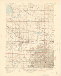
1944 Map of Arvada
USGS Topo · Published 1944About this map
Clear Creek and a dense network of irrigation channels like the Farmers High Line Canal define this landscape on the northwestern edge of the Denver area. The 1944 survey captures several smaller residential clusters such as Arvada Heights, Wheatridge, and Mountainview before they were fully absorbed into the suburban expansion of the mid-twentieth century. Transportation is dominated by the Colorado and Southern and the Denver and Salt Lake Intermountain railroads, including specific Narrowgage lines that served the region's agricultural and industrial hubs. Institutional landmarks are prominent, including Bellevue College and Regis College, alongside the sprawling Crown Hill Cemetery. The mapping of several small schoolhouses, such as Lathrop Sch and Semper Sch, offers a look at the local educational infrastructure when these communities still maintained distinct identities.
Find a feature on this map
73 named features on this map. Tap any name to fly to it.
Don’t see what you’re looking for? This feature index may not catch every label — zoom into the map to look around manually.
Map Details
Editions of this 1944 Arvada Map
This is the sole edition of this map. No revisions or reprints were ever made.
Other maps of this area

1890 · East Denver
USGS Topo · 1:125,000

1899 · West Denver
USGS Topo · 1:125,000

1935 · East Denver Nos. 3 and 4
USGS Topo · 1:48,000

1938 · Morrison
USGS Topo · 1:24,000

1938 · Derby
USGS Topo · 1:24,000

1939 · Golden
USGS Topo · 1:24,000

1940 · Englewood
USGS Topo · 1:31,680

1940 · Eastlake
USGS Topo · 1:31,680

1940 · Lafayette
USGS Topo · 1:31,680

1940 · Derby
USGS Topo · 1:31,680