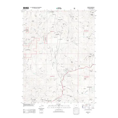
2013 Map of Conifer
USGS Topo · Published 2013About this map
Aspen Park and Conifer serve as the primary hubs in this part of the Front Range, where suburban residential growth meets the sprawling boundaries of the Arapahoe National Forest. The landscape is defined by its deep drainage networks, particularly the systems of N Turkey Cr, S Turkey Cr, and Turkey Cr which carve through the foothills near Berrian Mountain. Local aviation is represented by two private airstrips, the Marshdale Airport and Meyer Ranch Airport, reflecting the area's development as a mountain retreat for the Denver metropolitan region.
Find a feature on this map
54 named features on this map. Tap any name to fly to it.
Don’t see what you’re looking for? This feature index may not catch every label — zoom into the map to look around manually.
Map Details
Editions of this 2013 Conifer Map
This is the sole edition of this map. No revisions or reprints were ever made.
Other maps of this area

1893 · Platte Canyon
USGS Topo · 1:125,000

1899 · West Denver
USGS Topo · 1:125,000

1938 · Morrison
USGS Topo · 1:24,000

1942 · Morrison
USGS Topo · 1:31,680

1945 · Indian Hills
USGS Topo · 1:31,680

1945 · Platte Canyon
USGS Topo · 1:24,000

1945 · Pine
USGS Topo · 1:24,000

1945 · Bailey
USGS Topo · 1:24,000
1947 · Morrison
USGS Topo · 1:31,680

1948 · Pine
USGS Topo · 1:24,000