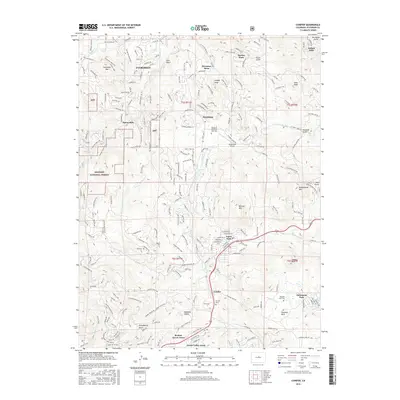
2016 Map of Conifer
USGS Topo · Published 2016About this map
Aspen Park and Conifer serve as central hubs in this Jefferson County landscape, where residential development like Broken Arrow Acres and Green Valley Acres sits alongside the steep terrain of the Front Range. The map illustrates a community shaped by its topography, with winding roads such as Evergreen Pkwy and Buffalo Park RD navigating the high elevations of Evergreen Mtn and Berrian Mtn. Significant land use is dedicated to the Arapaho National Forest, while local infrastructure is marked by the Marshdale Airport and several historic burial grounds, including Evergreen Memorial Park Cem and Pleasant Park Cem. The network of gulches and creeks, such as Parmalee Gulch and N Turkey Cr, dictates the placement of older settlements and modern subdivisions alike, providing a clear record of how this mountainous area transitioned from timber and ranching roots to a suburban-mountain enclave.
Find a feature on this map
247 named features on this map. Tap any name to fly to it.
Don’t see what you’re looking for? This feature index may not catch every label — zoom into the map to look around manually.
Map Details
Editions of this 2016 Conifer Map
This is the sole edition of this map. No revisions or reprints were ever made.
Other maps of this area

1893 · Platte Canyon
USGS Topo · 1:125,000

1899 · West Denver
USGS Topo · 1:125,000

1938 · Morrison
USGS Topo · 1:24,000

1942 · Morrison
USGS Topo · 1:31,680

1945 · Indian Hills
USGS Topo · 1:31,680

1945 · Platte Canyon
USGS Topo · 1:24,000

1945 · Pine
USGS Topo · 1:24,000

1945 · Bailey
USGS Topo · 1:24,000
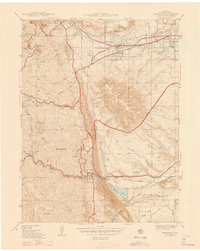
1947 · Morrison
USGS Topo · 1:31,680

1948 · Pine
USGS Topo · 1:24,000